Tropical storm has brought forth strong winds while a monsoon trough is causing very heavy rain in the upper Northeast and the East of Thailand. People in risk areas are urged to beware of associated hazards.
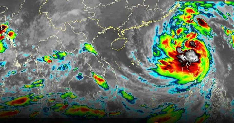
The weather bureau reports that severe tropical storm Kompasu, with its epicenter currently in the upper South China Sea, is expected to pass over China’s Hainan Island and make landfall in upper Vietnam sometime today (14 Oct). The storm is then expected to gradually weaken. Meanwhile, a strong southwest monsoon prevails across the Andaman Sea, Thailand’s South and the Gulf of Thailand.
A monsoon trough lies across Thailand’s Central Region, Eastern Region and the lower part of the Northeastern Region. As a result, very heavy rain is likely in the upper Northeast and the East. Heavy rain is forecast for the lower Northeast, the South and the Central Region.
People in risk areas are urged to take caution against dangers resulting from heavy rain and accumulated rainwater, as well as flash floods and forest runoffs.
Waves in the Andaman Sea and the upper Gulf of Thailand are 2-3 meters high whereas in the lower Gulf they are 2 meters high. In thundershower areas, waves could exceed 3 meters in height. Small boats in the Andaman and the Gulf should keep ashore during this time. (NNT)
 |
 |
 |


