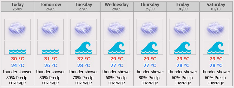
Pattaya and Eastern Part Weather Forecast
Fairly widespread thundershowers with isolated heavy to very heavy rains in Nakhon Nayok, Prachinburi, Chachoengsao, Chonburi (Pattaya), Rayong, Chanthaburi and Trat. Minimum temperature 23-25 °C. Maximum temperature 28-32 °C. Southwesterly winds 15-35 km/hr. Wave height about 1 meters and 1-2 meters in thundershowers.
Scattered to fairly widespread thundershowers with isolated heavy rains throughout the period and isolated very heavy rain with gust during 28 – 30 Sep.
During 25 – 26 Sep, Variable winds 15-35 km/hr. Wave height 1-2 meters and above 2 meters in thundershowers.
During 27 Sep – 1 Oct, Southwesterly winds 20-40 km/hr. wave height 2-3 meters and above 3 meters in thundershowers. Minimum temperature 23-28 °C. Maximum temperature 29-36 °C.
Weather Warning
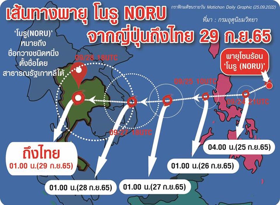
‘Tropical Cyclone Noru’
No. 2 Time Issued: September 24, 2022
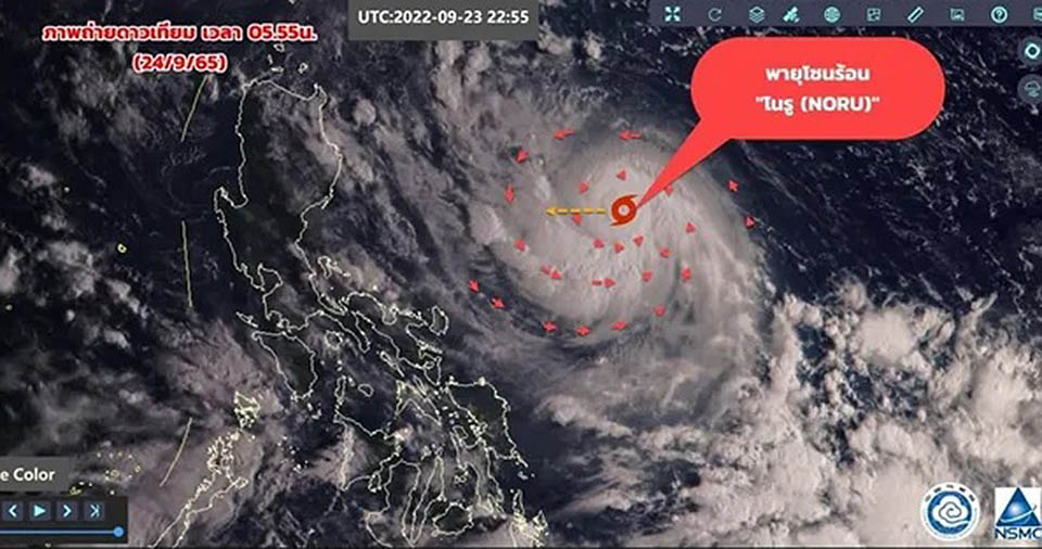
At 1.00 p.m. on 24 September, severe tropical storm Noru (2216) was due 600km east of Luzon, the Philippines, or latitude 15.8 degrees North and longitude 126.9 degrees East. With its maximum sustained winds about 110 km/hr, the storm is moving west-southwest about 20 km/hr passing the Philippines into the middle South China Sea on 25 and 26 September. The storm is expected to make landfall over middle Vietnam by 27 and 28 September. Heavy to very heavy rains are possible in some of the North, the Northeast, the Central and the East from 27 to 29 September. People should beware of the severe conditions that may cause flash floods and overflows, especially along the waterways near foothills and lowlands.
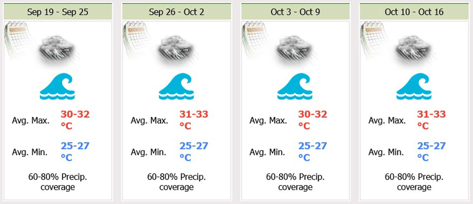
From 27 and 29 September, the southwest monsoon across the Andaman Sea, the South and the Gulf will become stronger. The strong wind forces the wave up to 2-3 meters high in the Andaman Sea and the upper Gulf and more than 3 meters high in thundershowers. All ships should proceed with caution and keep off thundershowers. Small boats in the Andaman Sea keep ashore. Please stay tuned for the weather update.

 |
 |
 |


