
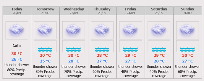
Monday until Wednesday (Sept 20-22), fairly widespread thundershowers and isolated heavy to very heavy rains are forecast in Nakhon Nayok, Prachin Buri, Chachoengsao, Sa Kaeo, Chonburi (Pattaya), Rayong, Chanthaburi and Trat. Minimum temperature 22-25°C and maximum temperature 27-32°C. Southwesterly wind 20-35 km/hr. Wave height about 2 meters and above 2 meters in thundershowers.
Across Thailand
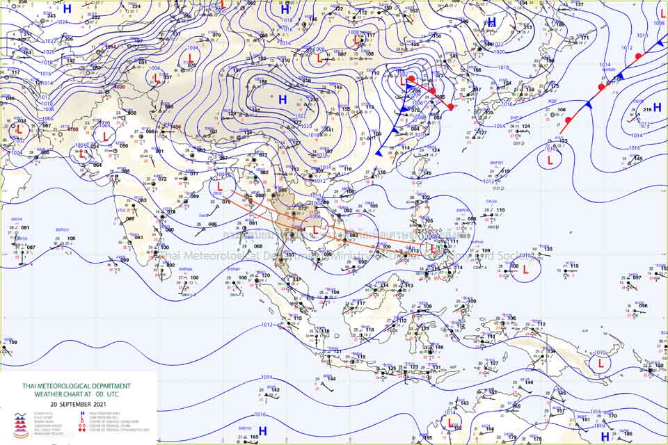
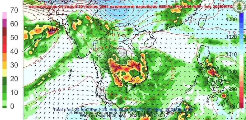
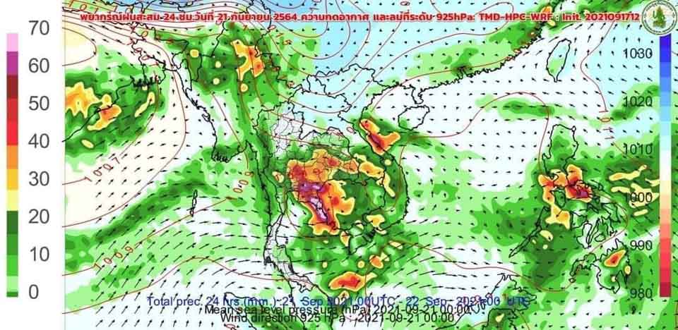
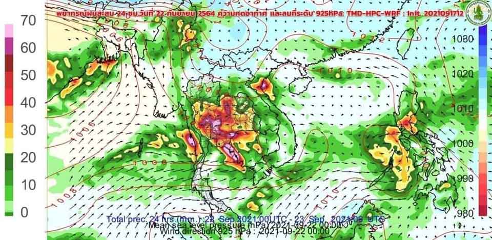
The low-pressure over Cambodia will move into the monsoon trough lies across the Central, the East and the lower Northeast. The southwest monsoon prevails over the Andaman Sea, the South and the Gulf of Thailand will strengthen. More rains will be likely over the country with isolated heavy to very heavy rains in the North, the Northeast, the Central, the East including Bangkok and its vicinity and the South region. People in the risk areas should beware of severe rain and its accumulation that may cause over flows and flash flood. The southwest monsoon prevails over the Andaman Sea and the Gulf of Thailand will be stronger, 1-2 meters high in the Andaman Sea, about 1 meter high in the Gulf of Thailand, and above 2 meters high in thundershowers. All ships proceed with caution and keep off thundershowers.
 |
 |
 |


