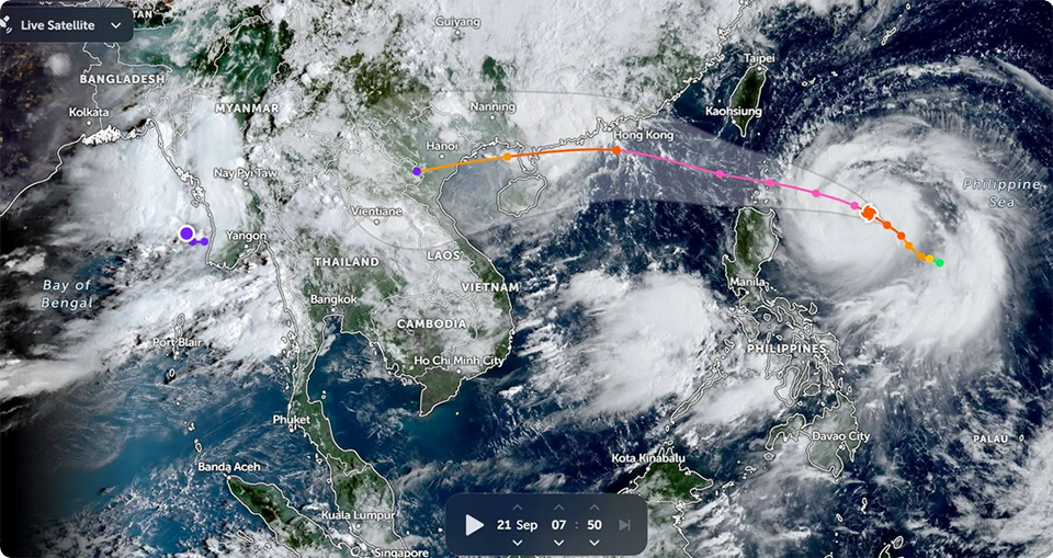
BANGKOK, Thailand – The Thai Meteorological Department (TMD) issued an update on September 21 regarding Typhoon Ragasa, which remains over the western Pacific Ocean east of the Philippines and is moving northwest. While the storm has not yet reached Thailand, its outer influence is contributing to unstable weather across parts of the country.
Satellite and radar images from Sunday morning (Sept 21) showed cloud bands and rain clusters over the northern and upper northeastern regions. These conditions are being driven by a monsoon trough across the northern and upper northeastern areas, combined with a moderate southwest monsoon covering the Andaman Sea, the Gulf of Thailand, and much of the country.
Heavy rainfall is expected in the next 24 hours in provinces such as Mae Hong Son, Tak, Chanthaburi, and Trat. Authorities warned that flash floods and runoff could occur in vulnerable areas due to accumulated rain, especially in low-lying terrain and near waterways.
At sea, waves in the upper Andaman Sea are forecast to reach approximately two meters, while the lower Andaman Sea and the upper Gulf of Thailand are expected to experience waves of one to two meters. In thunderstorm zones, waves may exceed two meters.
Mariners have been advised to navigate with caution and avoid storm-affected waters, as rough conditions are expected to persist during this period. (NNT)


