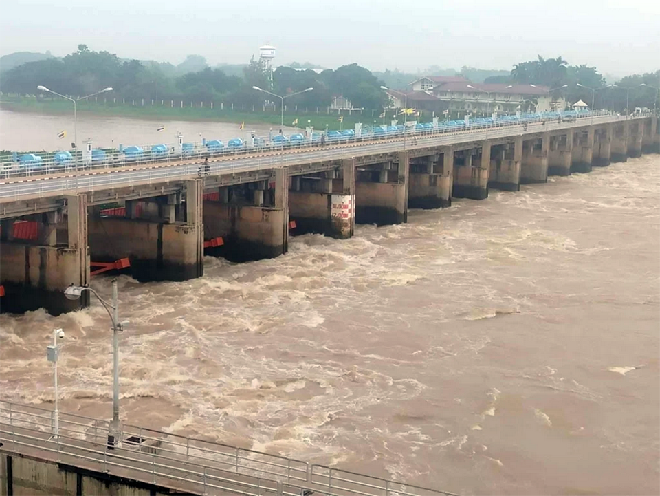
BANGKOK, Thailand – The Royal Irrigation Department (RID) may increase water discharge from the Chao Phraya Dam to 2,000–2,500 cubic meters per second following approval by the National Water Resources Committee (NWRC), as upstream inflows continue to rise amid ongoing heavy rainfall and a shifting monsoon trough over central Thailand.
Thanes Somboon, Director of the RID’s Water Management and Hydrology Bureau, said that water flow at the C.2 station in Mueang Nakhon Sawan district reached 2,250 cubic meters per second this morning and is expected to increase further. Releasing additional water could raise downstream levels by 40–60 centimeters.
The RID is closely monitoring communities along the Chao Phraya, particularly in Uthai Thani and Chai Nat provinces, where higher upstream levels could impact riverside areas. Irrigation canals are being filled to capacity to help manage the flow, and water releases from Sirikit Dam in Uttaradit have been adjusted to reduce downstream pressure.
At-risk areas downstream of the Chao Phraya Dam include:
Chai Nat: Phon Ngam Damok Out and Ban Tha Sai, Sapphaya District
Singburi: Wat Sing, In Buri District; Phrom Buri District; Wat Suea Kham, Mueang Singburi District
Ang Thong: Wat Chaiyo, Thewarat Subdistrict; Pa Mok District; Khlong Phong Phaeng
Ayutthaya: Hua Wiang Subdistrict, Sena District; Lat Chit and Tha Din Daeng Subdistricts, Phak Hai District; riverside areas along Khlong Bang Ban and Mae Nam Noi
The RID is also operating pumps and water-propelling machines in the lower Chao Phraya basin to expedite drainage into the Gulf of Thailand while clearing waterways of obstacles. Authorities continue to coordinate with relevant agencies to monitor and assess the situation, aiming to minimize impact on local communities. Residents are urged to follow official updates from the RID closely. (TNA)


