
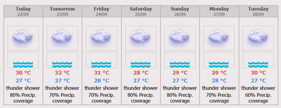
During 24 – 26 Sep, fairly widespread thundershowers and isolated heavy rains in Nakhon Nayok, Prachin Buri, Chachoengsao, Sa Kaeo, Chonburi (Pattaya), Rayong, Chanthaburi and Trat. Minimum temperature 23-27 °C and maximum temperature 30-32 °C. Southwesterly winds 20-35 km/hr. Wave height about 2 meters and above 2 meters in thundershowers. People in the risk areas should beware of severe rain and its accumulation that may cause over flows and flash flood in low lands.
Across Thailand
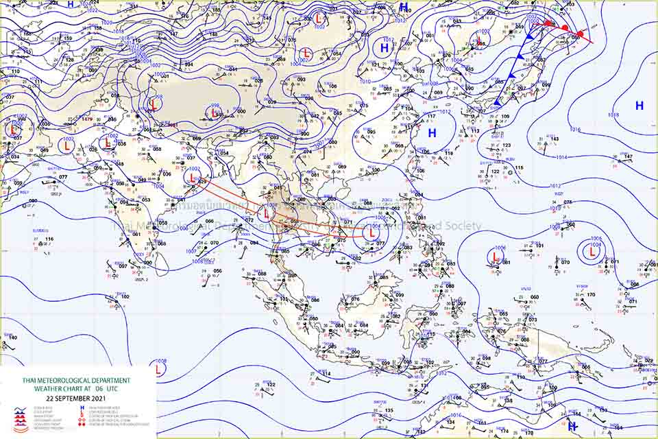
The monsoon trough lies across the lower Central, the East and the lower Northeast regions while the southwest monsoon prevails over the Andaman Sea, the South and the Gulf of Thailand. The low-pressure cell covers the lower Central move to Gulf of Martaban. The country is continued with rainfall and isolated rains. People in the risk areas should beware of severe rain and its accumulation that may cause over flows and flash flood.
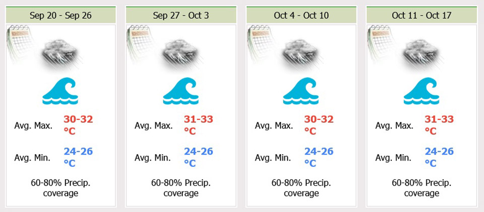
The moderate southwest monsoon prevails over the Andaman Sea and the Gulf of Thailand, about 2 meters high in the Andaman Sea and the upper Gulf of Thailand, 1-2 meters high in the lower Gulf of Thailand, and above 2 meters high in thundershowers.
All ships proceed with caution and keep off thundershowers. The active low pressure cell covers the middle South China Sea. It is forecast upgrade and to move to middle Vietnam (on 24 Sep) as well as move follow the monsoon trough that covers the lower Northeast of Thailand.
 |
 |
 |


