BANGKOK, Thailand – Thailand has seen a continued decline in fire hotspot numbers, according to the latest satellite data, although forested areas remain heavily affected and neighboring countries continue to record very high levels of burning activity, raising concerns over transboundary haze.
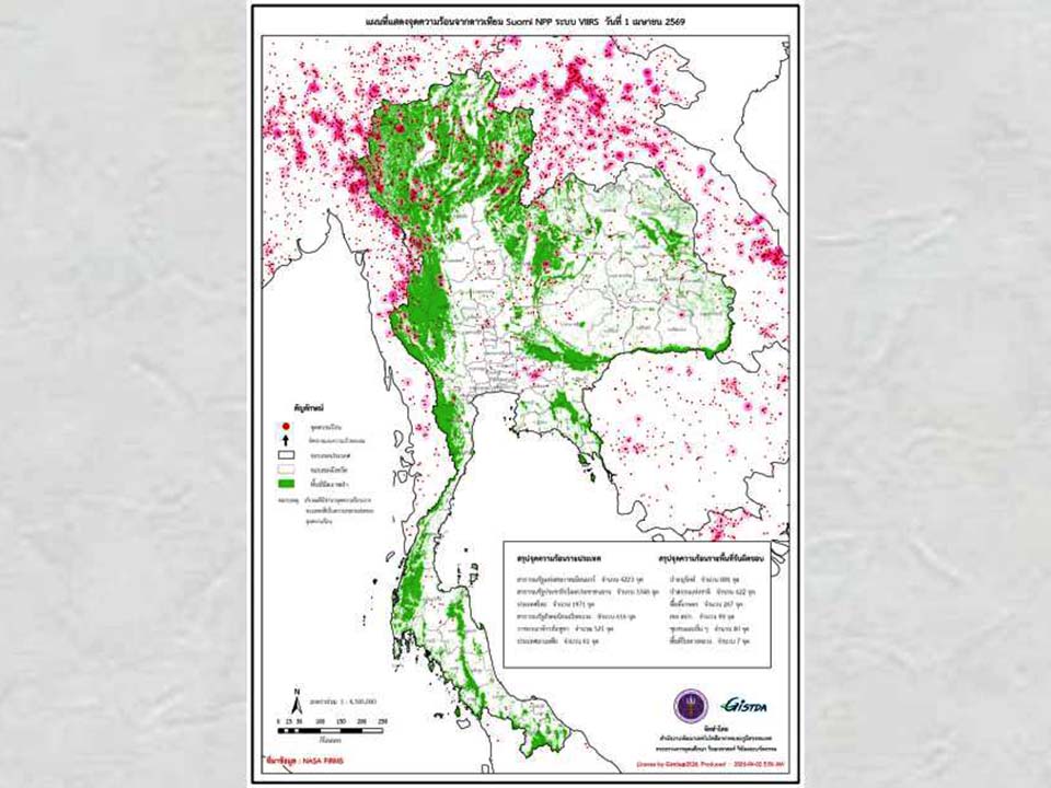
The Geo-Informatics and Space Technology Development Agency (GISTDA) reported that data from the Suomi NPP satellite’s VIIRS system recorded 1,971 hotspots across Thailand on April 1, down from 2,326 the previous day.

Most hotspots in Thailand were detected in protected forest areas, followed by national forest reserves, agricultural land, land reform zones, communities, and roadside areas. Authorities noted that while the overall trend is improving, forest fires remain a persistent issue, particularly in northern regions already affected by PM2.5 pollution.
Across the region, neighboring countries continue to show significantly higher fire activity. Myanmar recorded more than 4,200 hotspots, followed by Laos with over 3,300, Vietnam with 616, Cambodia with 521, and Malaysia with 61. Officials say this regional pattern remains a key factor contributing to seasonal haze that can drift across borders into Thailand.
Although Thailand’s situation is improving, experts stress that the risk has not disappeared, especially as northern provinces continue to experience elevated air pollution levels linked to forest fires and agricultural burning.
Authorities are urging the public to monitor real-time hotspot data and remain alert as conditions can change quickly depending on weather and wind patterns. (TNA)


