PATTAYA, Thailand – Thailand’s Meteorological Department has warned that a new wave of cool air from China is spreading southward, bringing the risk of thunderstorms and strong winds to parts of the eastern region, including Pattaya, as well as the Northeast and Central Thailand.
According to the department, a moderate to fairly strong high-pressure system has already covered southern China and northern Vietnam and is expected to extend over upper Laos, upper Northeast Thailand, and the South China Sea by Saturday night.
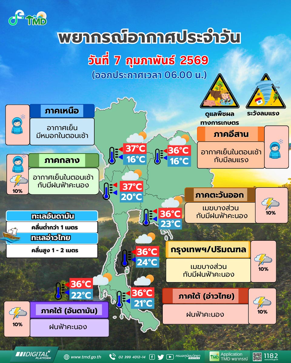
This weather pattern is strengthening winds over the Northeast, while southerly and southeasterly winds are drawing moisture from the Gulf of Thailand and the South China Sea into the Central region, Bangkok, surrounding provinces, and the Eastern seaboard. As a result, Pattaya and nearby areas may experience isolated thunderstorms accompanied by gusty winds.
Authorities have advised residents in upper Thailand to take care of their health as weather conditions fluctuate. Farmers are urged to protect crops and livestock from potential damage caused by rain and strong winds.
In the southern region, scattered thunderstorms are still expected due to the northeast monsoon prevailing over the Gulf of Thailand and the South. In the lower Gulf of Thailand, waves are moderate at around 1–2 metres, rising above 2 metres in areas affected by thunderstorms. Mariners in both the Gulf of Thailand and the Andaman Sea are advised to proceed with caution.
Meanwhile, air quality remains a concern, with dust and haze accumulation at moderate levels across the North, Central region, and Bangkok, caused by weak air circulation and lighter winds. Similar conditions may affect parts of the eastern region, including coastal tourist areas.
The Meteorological Department continues to monitor the situation and advises the public, especially those in coastal and tourist zones such as Pattaya, to stay alert for sudden weather changes.


