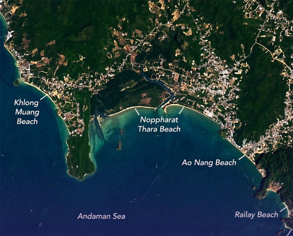
KRABI, Thailand – Satellite imagery released by NASA is drawing global attention to Thailand’s Andaman coastline, showcasing the landscape of Krabi province from space.
The image, published by NASA’s Earth Observatory, was captured by the Operational Land Imager aboard Landsat 8. It shows long stretches of pale sandy beaches alongside limestone mountains, mangrove forests, and coastal communities, highlighting the area’s appeal as a major tourism destination.
The imagery features well-known sites such as Railay Beach and Phra Nang Beach, where steep limestone cliffs rise along the shoreline and attract rock climbers. These formations developed over millions of years from marine deposits that were later uplifted and shaped by natural erosion in a tropical environment.
Other visible locations include Ko Poda and Ko Hong, known for their cliffs and caves, as well as Khao Ngon Nak, a viewpoint overlooking the Andaman Sea. Mangrove forests line waterways such as Klong Jilad, adding to the region’s diverse landscape and reinforcing its reputation as a leading travel destination. (NNT)


