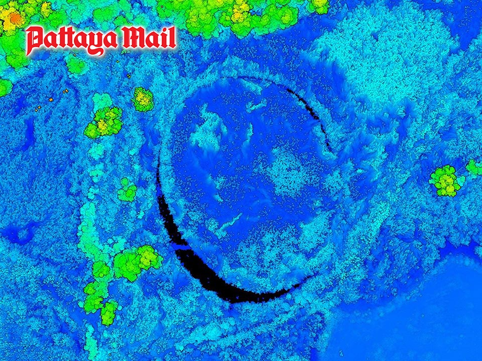
BANGKOK, Thailand – A mysterious circular formation known locally as the “Eye of Thailand” has been revealed to be a remarkable natural phenomenon after being investigated using advanced LiDAR technology by Thailand’s Geo-Informatics and Space Technology Development Agency (GISTDA). What appeared at first glance to be an unusual pattern hidden beneath dense vegetation in Pathum Thani province has now been identified as a rotating floating island of weeds and soil, shaped over time by natural forces. GISTDA, a government agency under the Ministry of Higher Education, Science, Research and Innovation, unveiled striking LiDAR imagery that resembles abstract artwork but is actually a highly detailed three-dimensional map generated from millions of elevation data points.
The images were created using drones equipped with LiDAR (Light Detection and Ranging) technology, which fires laser pulses toward the ground and measures the time taken for the reflections to return. This allows scientists to calculate surface elevations with centimeter-level accuracy and see through dense vegetation that would otherwise conceal features below. While conventional aerial photography showed little more than a blanket of green vegetation, the LiDAR scans revealed a nearly perfect circular structure hidden within a wetland environment. Color-coded imagery highlighted differences in elevation, with greens, yellows, and oranges representing dense vegetation and treetops, while blues indicated lower-lying ground surfaces. Black crescent-shaped areas marked locations where laser signals could not penetrate water.
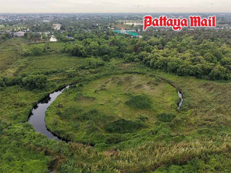
The unusual formation prompted further investigation, leading GISTDA researchers to conduct a drone survey on June 8. Initial theories suggested the circular feature may have been linked to historical land-use activities, such as excavation or abandoned earthworks. However, field observations revealed a far more fascinating explanation. Researchers discovered that the feature is actually a rotating floating island, formed when dense mats of aquatic vegetation and accumulated soil detached from the shoreline and began floating freely on the water’s surface.
As the vegetation continued to grow and compact over time, wind and water currents gradually caused the floating mass to rotate. This slow but constant movement repeatedly rubbed against surrounding banks and vegetation, effectively acting as a natural lathe that gradually sculpted both the floating island and surrounding water channel into an almost perfectly circular shape. The discovery highlights the power of modern geospatial technologies to reveal hidden aspects of the natural world that cannot be detected with the naked eye.
According to GISTDA, the LiDAR survey demonstrates that space and geospatial technologies are not only valuable for mapping infrastructure and forests but also for understanding complex natural processes and uncovering previously hidden landscape features. The findings have transformed what was once a local mystery into a vivid example of how advanced technology can help explain the remarkable forces of nature operating quietly beneath the surface.


