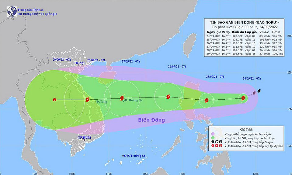
At 10.00 a.m. on 27 September, typhoon Noru over the middle South China Sea was due 380 km southeast of Danang, Vietnam or latitude 15.3 degrees North and longitude 111.7 degrees East. With its sustained winds about 156 km/hr, the storm is moving west at a speed about 30 km/hr to make landfall over middle Vietnam by 28 September.
It will then weaken to a tropical storm before moving pass the lower Laos and moving into the middle and the lower Northeast on 29 September. It will then weaken to a tropical depression, respectively.
Meanwhile, the southwest monsoon across the Andaman Sea, southern Thailand and the Gulf will strengthen. It will affect heavy rains in much of the North, the Northeast, the Central including Bangkok and its vicinity, the East and the South. All those regions will also have very heavy rains and gusty winds in some places. People should beware of the severe conditions that may cause flash floods and overflows, especially along the waterways near foothills and lowlands. Residents along the seashore should beware of inshore surges.


 |
 |
 |


