PATTAYA, Thailand – Thailand’s Meteorological Department has issued its sixth warning on Tropical Storm Maysak, urging residents across much of the country to prepare for heavy rain, possible flash floods, and dangerous weather conditions over the coming days. Although the storm is not expected to make landfall in Thailand, forecasters warn that its circulation will significantly strengthen the southwest monsoon and intensify the monsoon trough stretching across northern Thailand.
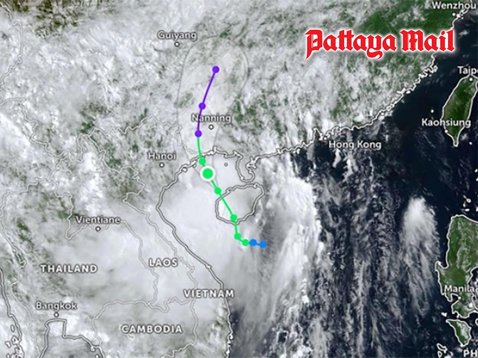
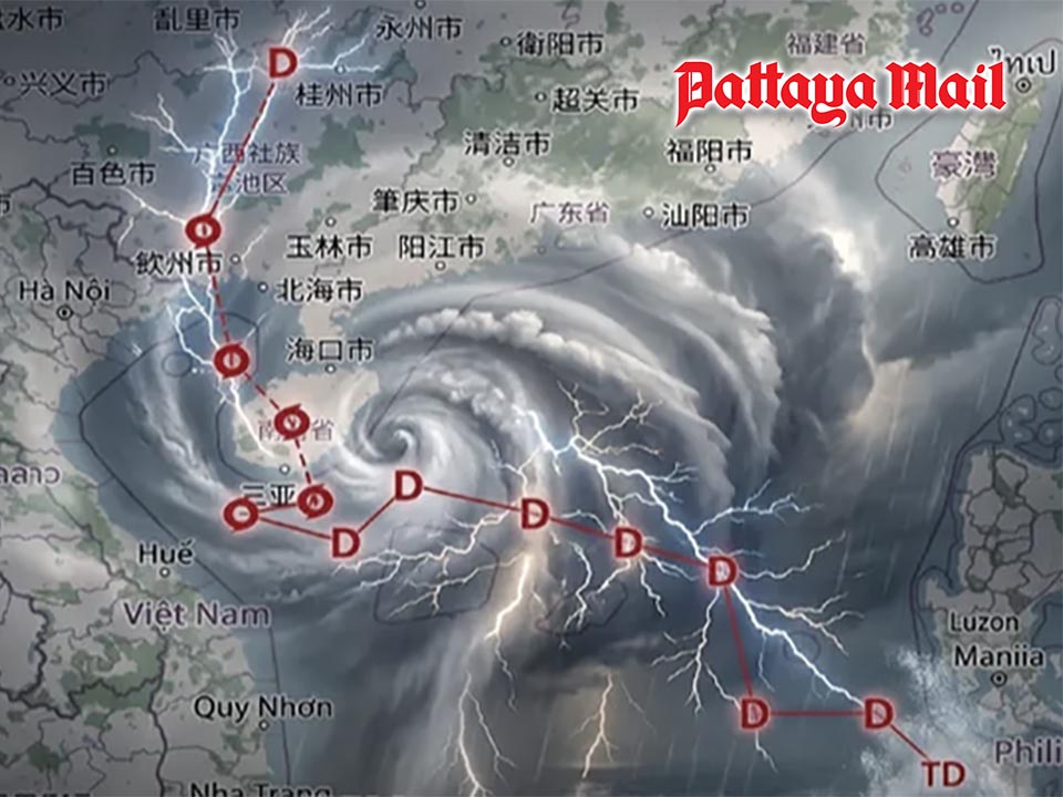
Maysak is forecast to move across Hainan Island before making landfall near Nanning in southern China on July 5. Despite remaining outside Thai territory, the storm is expected to have a widespread indirect impact, bringing periods of heavy to very heavy rainfall across large parts of the country.
The Meteorological Department has warned that July 5–6 will be a critical period, with residents in the North, Northeast, Central Plains, East, and the Andaman coast urged to monitor weather updates closely.
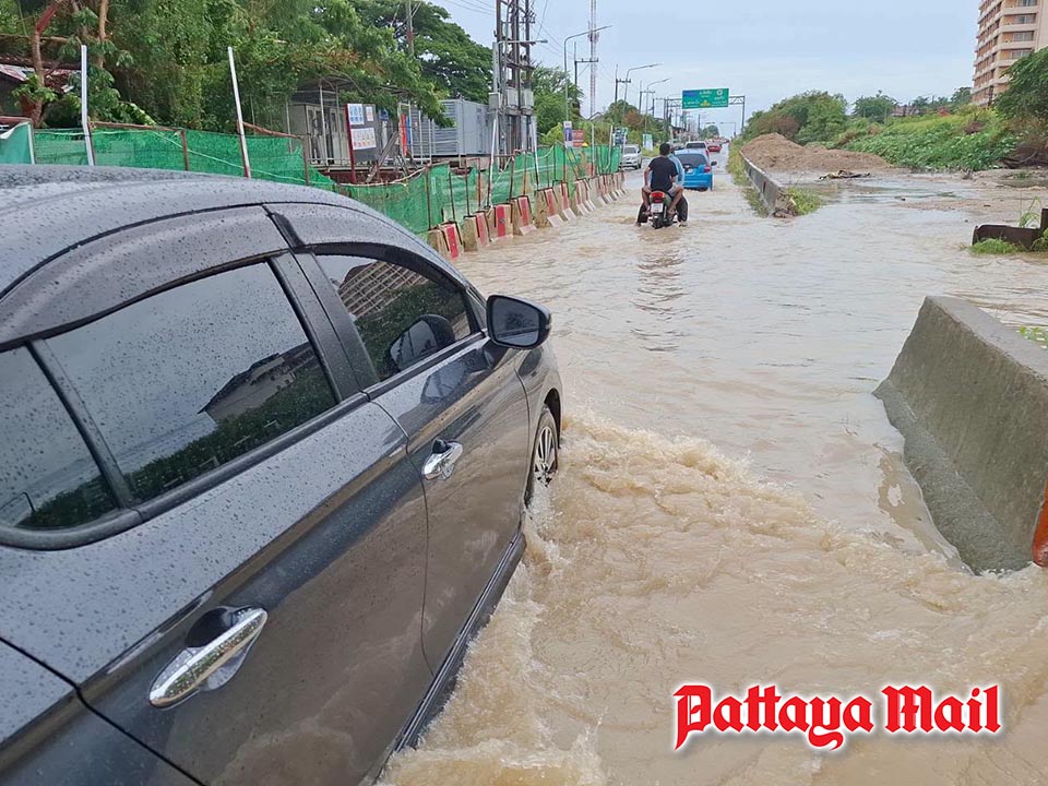
Authorities are warning of flash floods, forest runoff, and overflowing waterways, particularly in mountainous areas, foothills, low-lying communities, and locations with a history of flooding.
Provinces under close watch include:
- North: Mae Hong Son, Chiang Mai, Chiang Rai, Lampang, Lamphun, Phayao, Nan, Phrae, Uttaradit, Tak, Phitsanulok and Phetchabun.
- Northeast: Loei, Nong Khai, Bueng Kan, Udon Thani, Sakon Nakhon, Nakhon Phanom, Khon Kaen, Chaiyaphum, Kalasin, Mukdahan, Amnat Charoen, Yasothon and Ubon Ratchathani.
- Central: Nakhon Sawan, Uthai Thani, Lopburi, Saraburi, Kanchanaburi, Ratchaburi and Nakhon Nayok.
- East: Prachin Buri, Sa Kaeo, Chachoengsao, Chonburi (Pattaya), Rayong, Chanthaburi and Trat.
- Southern Andaman Coast: Ranong, Phang Nga, Phuket, Krabi, Trang and Satun.
The department is urging residents living in flood-prone areas to stay informed through official weather advisories and prepare for possible emergency situations. People travelling through mountainous regions or areas known for seasonal flooding are advised to exercise extra caution, as rapidly rising water levels and landslides remain a possibility.
Marine operators in both the Andaman Sea and the Gulf of Thailand have also been warned to navigate with extreme care. Thunderstorms may generate rough seas and strong winds, while small boats in high-risk areas are advised to remain ashore until conditions improve. The Meteorological Department stressed that even though Tropical Storm Maysak will strike China rather than Thailand, its indirect effects could still bring dangerous weather to much of the kingdom, making it essential for the public to closely follow official warnings throughout the weekend.


