

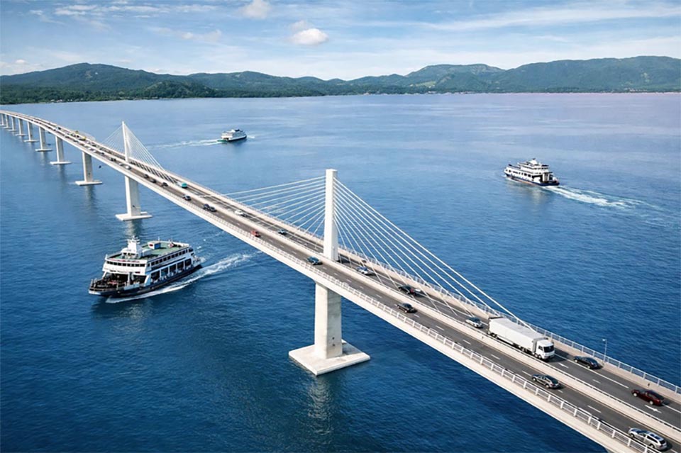
TRAT, Thailand – Plans for a 15-billion-baht elevated sea bridge linking mainland Trat with Koh Chang are moving forward, with officials selecting a 5.9-kilometre route and preparing environmental and land-expropriation procedures. The project is being viewed as a major piece of infrastructure that could improve transport between Koh Chang and the mainland while creating new opportunities for tourism and economic development in Trat.
Local residents have generally not opposed the project but have called for fair and appropriate compensation for land affected by the planned route. Kritchit Wilaisilp, a senior highway engineer, said studies of possible routes considered factors including the shortest distance and the fewest constraints. Route 3 was selected as the preferred alignment.
The route will begin near the junction with Rural Road Trat 4006 at kilometer 2+790 in Ban Thammachat Lang, Khlong Yai subdistrict, Laem Ngop district. It will head south through agricultural land before crossing the sea and end near the junction with Trat Provincial Administrative Organization Road 10026 at kilometer 5+435 in Ban Dan Mai, near the Koh Chang Provincial Electricity Authority office.
The crossing will be an elevated bridge carrying one traffic lane in each direction. Each main lane will be 3.5 meters wide, with a 0.5-metre inner shoulder and a 3.5-metre outer shoulder. A dedicated motorcycle lane will also be provided, following requests from Koh Chang communities. The Motorcycle Exclusive Lane, including the shoulder, will be approximately three meters wide.
The bridge will use two different structural designs. The longest spans will use an extradosed bridge design with 240-metre spans between piers, allowing large vessels to pass beneath the crossing. Standard sections will use a balanced cantilever design with 120-metre spans.
The project is currently in its second phase, scheduled for 2027–2029, covering preparation of the environmental impact assessment, land-expropriation process, detailed project design and budget.
The project will then be submitted to the Transport Ministry and Cabinet for approval. Construction is currently estimated to cost about 15 billion baht.
Land acquisition and compensation procedures are expected to begin around 2030–2031. If the process proceeds according to schedule, construction could begin in 2031, take approximately three to four years and allow the bridge to open around 2035. Another key issue is the toll.
Kritsada Chantrasena, director of the Environmental Management Division under the Expressway Authority of Thailand’s project development department, said the preliminary policy was to set tolls at a level close to existing ferry fares.
The proposed rate is about 200–300 baht per vehicle. The crossing would operate 24 hours a day, providing an alternative to ferry services and allowing residents and visitors to travel between Koh Chang and the mainland at any time.
Officials said the permanent connection would be particularly important for residents requiring urgent medical treatment on the mainland, while also reducing transport constraints and helping tourism and the wider local economy.
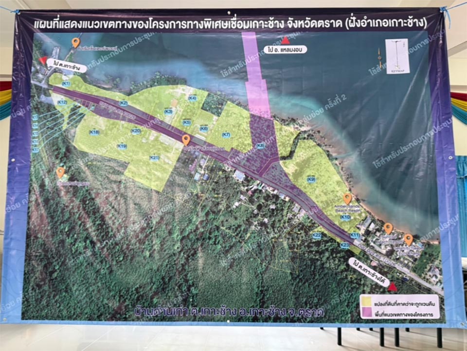
65 Land Plots Facing Expropriation
Preliminary surveys indicate that 65 land plots will be affected by the project.
On Koh Chang, 23 plots covering approximately 18 rai, three ngan and 95 square wah are expected to be affected, with 12 structures on the land.
On the mainland in Khlong Yai subdistrict, Laem Ngop district, 42 plots covering approximately 41 rai, two ngan and 94 square wah are included, with 26 structures. Specialist environmental consultant Dr Phiset Senawong said compensation would be determined under Thailand’s 2019 Land Expropriation and Acquisition Act and related laws. The assessment will consider market prices, property transaction prices during the previous two years, prices of comparable land within a two-kilometre radius, bank valuations and official government appraisals.
Other compensation would cover buildings, demolition, relocation, construction of replacement structures and other damages, as well as land-transfer and subdivision fees. Landowners who agree to hand over their property within 120 days would receive an additional two percent compensation payment on the land value. If an agreement cannot be reached within 180 days, the process would proceed under the legal expropriation procedure, including issuance of a royal decree. Compensation funds would then be deposited with Government Savings Bank in accordance with the law.
Standing trees would also be compensated according to their type and condition. Large mature premium durian trees producing fruit, for example, would receive compensation of 28,000 baht per tree. Kritsada said preliminary estimates put total land-expropriation costs at around several billion baht. The Expressway Authority is also preparing a market-sounding exercise in October or November to gauge private-sector interest in participating in the project.
Residents Want Fair Compensation
Siri Saelao, a trader and landowner in the planned expropriation area of Laem Ngop, said he purchased 16 rai of land two years ago to build a storage warehouse and expects about three rai to be affected. He said he did not oppose the project and understood the benefits it could bring, but was concerned that compensation might not fully reflect the land’s current or future value. He called for compensation to be calculated fairly and appropriately. Siri said the bridge could eventually reduce the cost of transporting goods compared with relying on sea transport and generate greater economic value for Trat.
Jakkrit Salakphet, mayor of Koh Chang Tai Municipality and a representative of local residents, said the proposed approach to comparing market prices with official valuations appeared reasonable.
Land prices on the Koh Chang side have risen significantly, particularly in areas close to the sea and beaches. Coastal land can reportedly sell for around 7–8 million baht per rai, while ordinary plots along roads can command around 2.5–3 million baht per rai.
Some properties also contain resorts, accommodation businesses, agricultural operations and other commercial developments, with compensation to be assessed according to the applicable rules.
Because expropriation is not expected to begin until around 2030, affected landowners and tenants may continue using their properties for another four to five years. Jakkrit also said land remaining after expropriation and areas around the future bridge, particularly Ban Dan Mai where the road will directly pass through, could attract new investment before construction begins and potentially push land prices higher.
Locals Seek Special Toll Rate
Local residents are also asking the Expressway Authority to introduce a special toll rate for people who regularly travel between Koh Chang and the mainland.
Jakkrit said the group includes residents, government employees and workers who live or work on the island but may not have their household registration there, as well as school vans travelling between the island and mainland every weekday. He proposed a registration system and special passes for local users, potentially using technology similar to Easy Pass or M-Flow. Local residents are seeking a toll discount of at least 50 percent.
Roads Must Keep Pace With Bridge
Another concern is whether Koh Chang’s existing road network will be able to handle additional tourists and vehicles once the new crossing opens. Jakkrit said road improvements must be carried out alongside the bridge project to prevent increased traffic from overwhelming the island’s existing infrastructure. One planned project is an 11-kilometre section linking Bang Bao and Salak Phet to the island’s road network. The project is awaiting Cabinet approval of the budget and is expected to take about two years to complete, potentially finishing in 2030.
The island’s wider road network covers about 70 kilometers and requires improvements and, in some areas, wider lanes to accommodate increased traffic and improve safety. Some sections could need to be widened from six meters to 10 meters. In particularly narrow areas, such as parts of Bang Bao, roads are reportedly only about two meters wide. However, much of the island falls within Mu Ko Chang National Park, meaning permission from the Department of National Parks, Wildlife and Plant Conservation would be required for work in protected areas.
Funding is another challenge because many roads fall under the responsibility of the Trat Provincial Administrative Organization, which has limited resources for major upgrades. Jakkrit also proposed setting motorcycle speeds at around 50–60 kilometers per hour on the new crossing. He said the journey would take only about six minutes at those speeds and that reasonable speed limits would be important because motorcycles, including big bikes, are widely used on Koh Chang.
The aim, he said, would be to reduce accidents and protect the island’s tourism image while ensuring that local residents unfamiliar with expressway-style roads can use the new route safely.
The Koh Chang bridge is therefore being presented not simply as a new connection between an island and the mainland, but as a major infrastructure project that will require land compensation, affordable access and significant improvements to the island’s road network before its full economic and tourism potential can be realized.