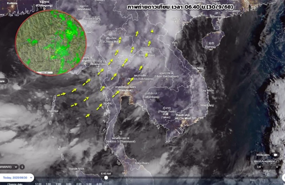
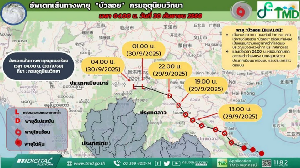
BANGKOK, Thailand – The Meteorological Department reported that tropical depression “Bualoi” has weakened into a strong low-pressure cell over Luang Namtha province, Laos, and is moving into northern Thailand today. Despite weakening, it will continue to bring heavy rain to the North and upper Northeast over the next 1–2 days, raising risks of flash floods, river overflows, and runoff before conditions begin to ease.
A total of 36 provinces are at risk of heavy rainfall today, including areas in the North (Chiang Mai, Chiang Rai, Nan, Phitsanulok, etc.), the Northeast (Loei, Udon Thani, Khon Kaen, etc.), the Central region (Nakhon Sawan, Bangkok and vicinity, etc.), the East (Chonburi, Rayong, Chanthaburi), and the South (Ranong, Phang Nga).
From October 1–6, rainfall is expected to gradually decrease as the monsoon trough weakens and shifts southward. Meanwhile, the southwest monsoon covering the Andaman Sea, the South, and the Gulf of Thailand will also weaken. However, seas remain moderately rough, with waves about 2 meters high in the upper Andaman, 1–2 meters in the lower Andaman and upper Gulf, and higher than 2 meters in storm areas. Mariners are advised to exercise caution and closely follow weather updates.
The Meteorological Department urged the public, especially in flood-prone and low-lying areas, to remain vigilant and follow official warnings during the next 1–2 days of accumulated rainfall. (TNA)


