BANGKOK, Thailand – Thailand’s Water Resources Agency urges preparedness from July 6–12, as heavy rainfall, rising rivers, and full reservoirs raise risk levels across the country.
Thailand’s National Water Resources Office (ONWR) has issued an urgent nationwide warning for heavy rainfall, flash floods, landslides, and potential river overflows between July 6 and 12, 2025, especially in northern and northeastern provinces. The agency is closely monitoring the Mekong River, which continues to rise steadily, though it has not yet breached riverbanks.
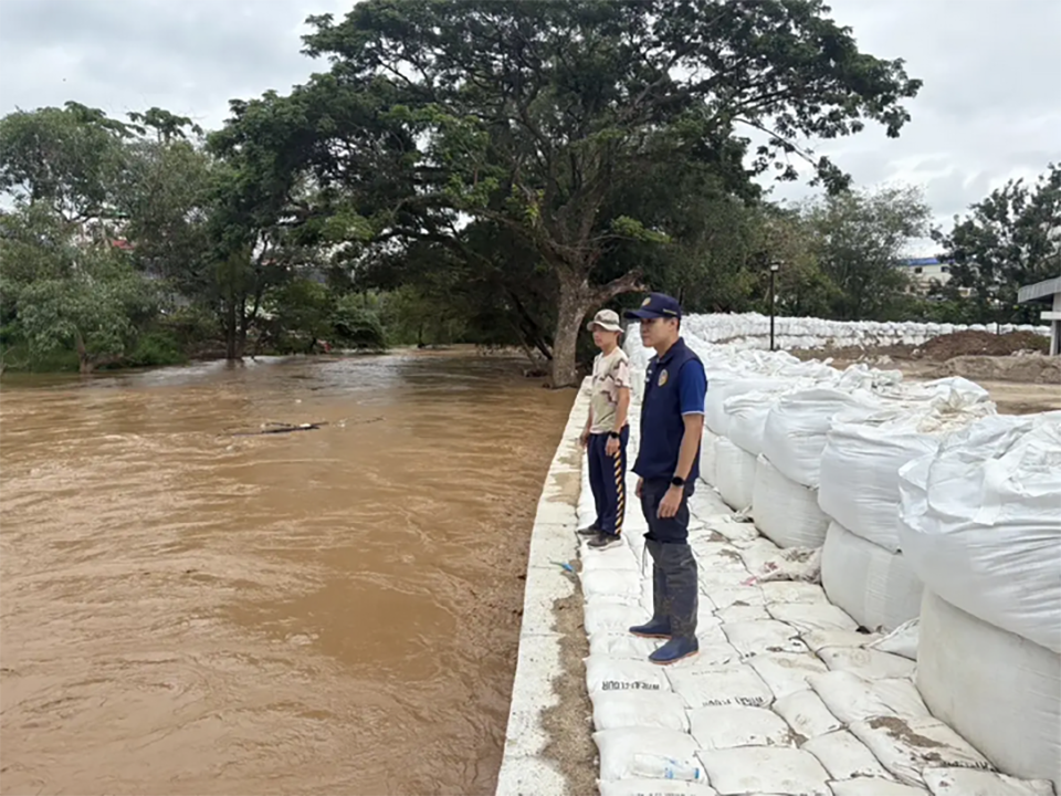
The public has been urged to remain calm but alert, especially in flood-prone areas, and to move belongings to higher ground in preparation for possible sudden water surges.
According to the ONWR’s 10th emergency bulletin of the year, the alert follows forecast data showing widespread rainfall and increasing water levels in tributaries and reservoirs. The agency is coordinating closely with the Meteorological Department, Department of Disaster Prevention and Mitigation, and the Department of Irrigation to issue early warnings and manage water levels.
High-Risk Provinces Identified Across All Regions
North: Chiang Rai, Nan, Phayao, Tak
Northeast: Loei, Nong Khai, Bueng Kan, Udon Thani, Sakon Nakhon, Nakhon Phanom, Yasothon, Ubon Ratchathani
East: Chonburi (Bang Lamung, Si Racha), Rayong, Chanthaburi, Trat
South: Ranong, Phang Nga, Phuket, Surat Thani
Reservoirs Near Critical Levels
Mid-sized and small reservoirs holding over 80% of their capacity are of particular concern in provinces like Lampang, Nan, Phitsanulok, Sakhon Nakhon, Udon Thani, Kalasin, Nakhon Ratchasima, Ubon Ratchathani, Chonburi, Chanthaburi, Trat, and Krabi.
Key water bodies such as Huai Thong and Huai Suang in Sakon Nakhon, Nong Ya Ma in Kalasin, and Dan Chumphon in Trat have been ordered to release water preemptively. Major lakes including Kwan Phayao, Nong Han, and Nong Kut Ting are also being managed closely.
Low-Lying Riverbanks at Risk
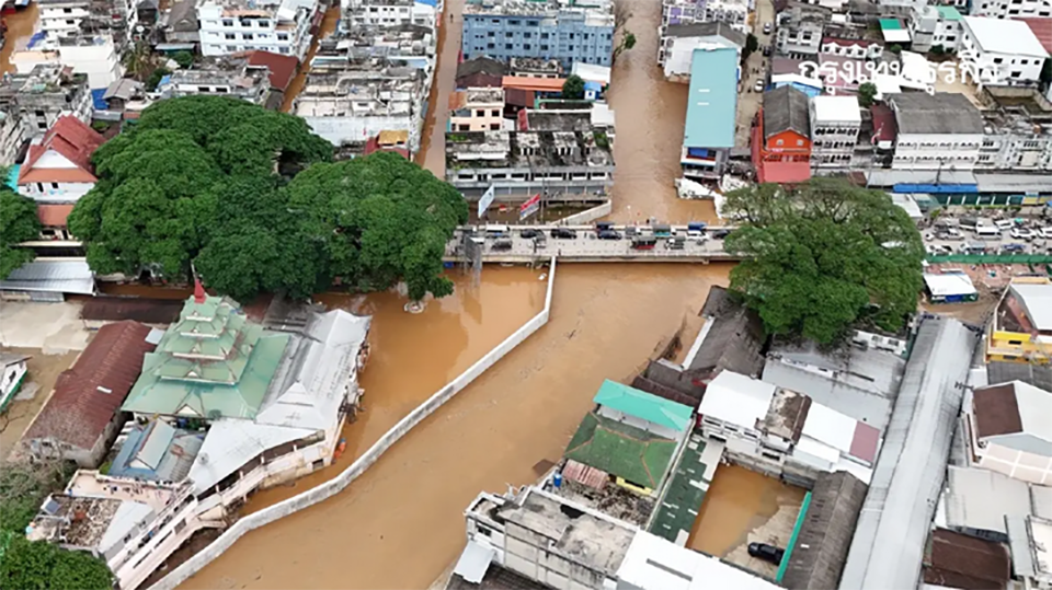
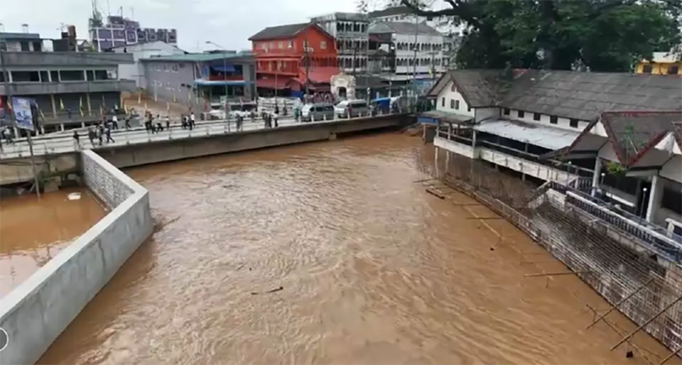
Local authorities in Chiang Rai are particularly monitoring the Ing River (Chiang Kham, Thoeng, Phaya Mengrai, Khun Tan, Chiang Khong) and Sai River (Mae Sai), which could flood low-lying areas due to accumulating rainfall.
Mekong Water Levels Still Below Bank Height — But Rising
The Mekong River has been rising continuously due to heavy upstream rainfall in Laos. While current levels remain below flood thresholds in riverside Thai provinces like Chiang Rai, Loei, Nong Khai, Bueng Kan, Nakhon Phanom, Mukdahan, Amnat Charoen, and Ubon Ratchathani, authorities remain on high alert.
Flood Response Plans Activated
ONWR has directed all relevant agencies to:
-Monitor high-rainfall zones (90mm+ in 24 hours)
-Clear drainage routes and reinforce embankments
-Synchronize upstream and downstream water management
-Prepare emergency machinery, personnel, and communication systems
-Pre-alert communities for potential evacuation


