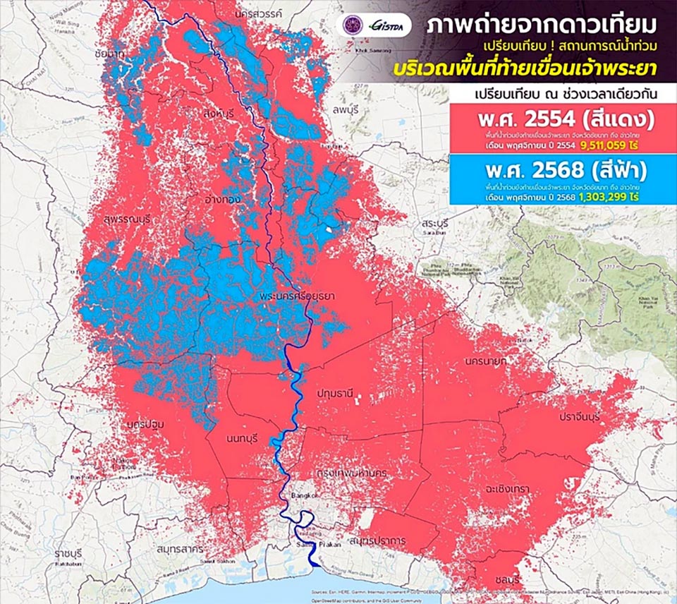
BANGKOK, Thailand – The Geo-Informatics and Space Technology Development Agency (GISTDA) has released satellite-based analyses comparing flooded areas along the Chao Phraya River basin—from Chai Nat province to the Gulf of Thailand—between November 2011 and November 2025.
Data shows a striking difference in flood severity between the two periods:
2011 Mega-Floods (red area): 9,511,059 rai inundated.
2025 Floods (blue area): 1,303,299 rai inundated.
GISTDA reports that the 2025 flooded area is more than 86% smaller than during the 2011 disaster.
The agency has shared the satellite imagery with key authorities to support planning, monitoring, and situational assessment. Citizens can follow near-real-time flood updates via GISTDA’s “Check Nam” application on iOS and Android.
Links for Public Use:
GISTDA Flood Updates
iOS App: Check Nam
Android App: Check Nam


