

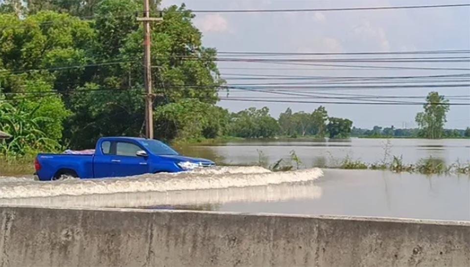
CHACHOENGSAO, Thailand – Floodwater from Khlong Si Yat Reservoir has begun spilling across sections of Highway 304 linking Chachoengsao with Kabin Buri, affecting traffic and communities along the route. The situation follows several days of water overflowing from the reservoir’s spillway and flowing into low-lying areas of Phanom Sarakham, Plaeng Yao, Ban Pho, Bang Khla and Mueang Chachoengsao districts.
At Sao Cha-ngok in Bang Khla district, water began entering the area at around 6 p.m. on October 2. Despite the area being relatively elevated, floodwater has reached almost 1 metre in some locations and has spread into nearby homes. Highway 304, an important route connecting eastern Thailand with the Northeast, has also been affected. At several points, water is now flowing across the road, while surrounding areas have been heavily flooded. Small vehicles are unable to pass some sections.
In Khlong Chuk Choe, Mueang Chachoengsao, the main route towards Wat Saman Rattanaram, one of the province’s major tourist attractions, is also impassable at some points. A narrower road along an irrigation canal is being used as an alternative route, but congestion has developed because of its limited width. Further along Highway 304, beneath the railway bridge near Wat Thot Rat Charoen Mani Rit in Bang Phai, floodwater covers several traffic lanes. The parallel inbound lanes from Phanom Sarakham are particularly badly affected, with water too deep for small vehicles.
Some motorcycles have also risked engine failure while attempting to cross sections where the water has risen above half the height of the vehicles. Traffic on the main lanes remains possible but is restricted by flooding on the left side. Water is also crossing the parallel outbound lanes beneath the bridge. Flooding continues from Bang Phai towards Wat Hua Suan. Near the bridge in front of Wat Hua Suan, around 10 centimetres of water covers both main lanes before extending towards the bridge near Wat Thot.
In Bang Khla, from Wat Hua Suan towards Phanom Sarakham, water has reached the road shoulder and is beginning to flow across the carriageway at some points. Traffic has become particularly heavy around the Nong Pla Tapian interchange, where vehicles leave the bridge and immediately encounter flooded sections. Road construction and widening works in the area have reduced traffic to one lane in each direction, forcing vehicles to share the narrowed roadway and causing periodic traffic build-up.
Residents living along Highway 304 are meanwhile pumping water from agricultural land, shrimp and fish ponds and residential areas in an effort to protect property and agricultural production while water continues flowing into the area. Motorists who need to use Highway 304 through the affected sections are advised to exercise caution, particularly where floodwater covers the road or construction is under way, as water levels and traffic conditions may change rapidly.