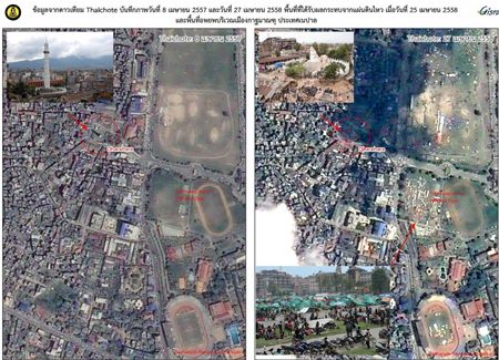
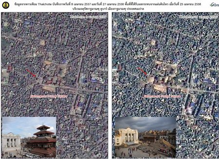
BANGKOK, 28 April 2015 – The Ministry of Science and Technology is to give to the United Nations sets of satellite images captured by Thaichote (THEOS) showing the landscape of Nepal before and after the powerful earthquake for use in the assessment of changes and damages of the area, Minister of Science and Technology Pichet Durongkaveroj said on Tuesday.
The images were captured on 27 April 2015 at 12.10 p.m. local time in Thailand, for comparison to those captured on 8 April 2015, nineteen days before the earthquake.
They were recorded by the Geo-Informatics and Space Technology Development Agency (GISTDA) at the order of the Science and Technology Minister.
GISTDA represents Thailand in the “Space applications for sustainable development in Asia and the Pacific” program. Members of the program are designated to support information to member states in case a disaster happens. Nepal is a member of the program.


